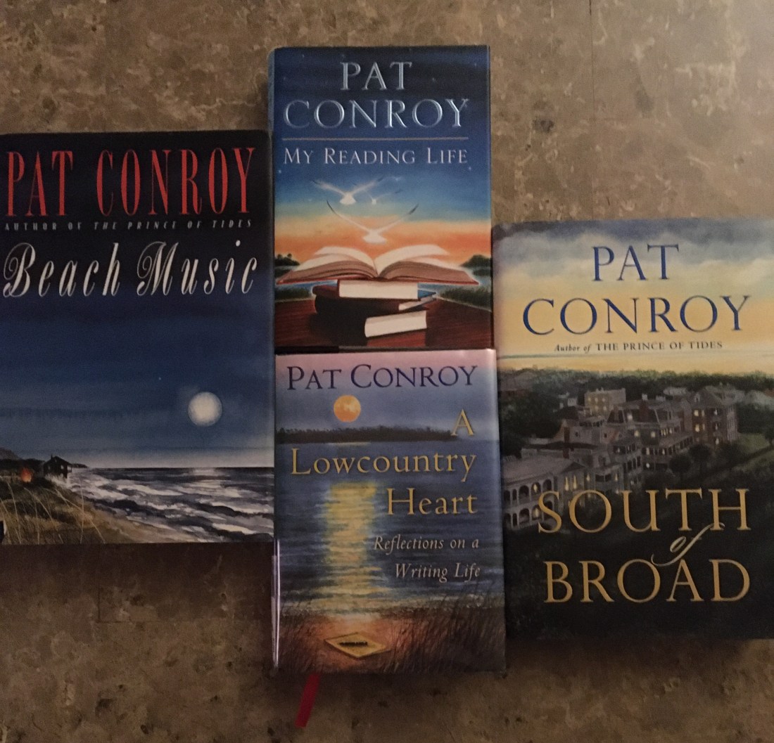
Rather than treat February 29th as just an additional day of winter and presidential campaigning, I converted the quadrennial calendar quirk into a treat for me. I used the extra day to read a book from start to finish. A rarity.
A Lowcountry Heartis a book both large enough in ideas and small enough in size that I could complete the task before evening dinner. The book is both by and about Pat Conroy, a tortured southern soul whose dysfunctional family and desperate college life provided subject matter for a half dozen popular and critically acclaimed novels he published before his death in 2016. The Prince of Tides is probably most famous of his fabulous work.
I had been unaware until now that Conroy started to blog in 2009. He labeled “blog” the “ugliest word in the English language.” So he referred to his postings as “letters” which he always began, “Hello, out there,” as if he were trying to communicate with space aliens.
An author who had never learned to type and had always created and composed by hand on a legal pad, Conroy was at first intimidated by this new medium. He said, “I’ve no idea what a blog is supposed to do or what it is supposed to consist of.”
But it didn’t take long for this irrepressible storyteller to find his groove. His “letters” tell the stories of people he had met in the past and of the relationships he continued to cultivate in the final chapter of his own life.
A Lowcountry Heart describes family, friends, teachers, coaches, teammates and especially writers, editors and agents, all made more memorable because of Conroy’s biting wit and love of language.
Sanbona Wildlife Reserve in South Africa’s Little Karoo is home to both the Common Zebra (shown here) and the Cape Zebra.
I have written before about the problem any person can have when describing where he or she has traveled: generalizing from too small a survey sample. There is probably no place I’ve visited where this is more apt to happen than South Africa.
The books I read before I departed for South Africa instilled some fear and a sense of hopelessness which I see from three weeks of experiences in both big cities and countrysides were not entirely unjustified, but probably overcooked. What I’m most surprised about now is the number of times I want to use superlative descriptors in writing about our experiences. For example….
Johannesburg, South Africa’s largest city, is said to have the nicest year-around weather of any of the world’s 50 largest cities, due to its altitude: highest of any major city of the world. I cannot dispute that the January (summertime) temperatures we experienced in Johannesburg were perfect: warm days and cool nights, with a brief afternoon rain.
At the same time of year, more charming Cape Town, a 150-minute flight toward Antarctica, may be one of the windiest cities in the world. Winds calmed during our visit, but we heard stories from a week earlier when tourists were roped together so they wouldn’t get blown away between their tour buses and hotels. That’s really embarrassing to think about so near to where gale-force winds around the Cape of Good Hope sank many ships traveling between Europe and Asia prior to the opening of the Suez Canal just 150 years ago.
Driving further down the country’s cape, while we passed many miles of gorgeous cliffs, dunes, beaches and ocean on the right side of the road, on our left, we passed the most extreme poverty we had ever seen on this planet. . . until we saw such pockets of poverty again, and still again, outside other cities and towns across South Africa
The next two days took us to the most expansive and least expensive wine region we’ve ever visited, where we found an unheralded winery (Jordan) to be a better experience than another which was more publicized and pretentious. Even in these lovely environs, a highway blockade reminded us of the divide between rich and poor as locals protested the arrest by government authorities of one of their own who was suspected of possessing drugs.
The following two days found us further inland where several years of drought have fried the Little Karoo to the driest it’s been in anyone’s memory. At the private Sanbona Wildlife Reserve, whose research is important at any time but especially critical during this period of unprecedented manmade and natural threats, we had the closest experiences of our lives with elephants, white rhinos and a cheetah, saw the rare Cape Zebra and glimpsed two of only ten white lions known to be in the wild anywhere in the world.
Eventually, we turned south again, and saw a fog bank descending like a down cover from the mountain tops that divide the Karoo from the Indian Ocean. It’s like two different worlds: sunny, hot, brown and rocky on one side; foggy, cool, green and wooded on the other. Those South Africa extremes, again, making this perhaps the most impossible country to generalize we’ve ever visited.
The southern coast of this country and continent is unmatched for sand dunes and soft beaches. They extend hundreds of yards inland from the edge of the Indian Ocean; they continue along the shore line — with only few and brief interruptions — for hundreds of miles. These pristine beaches are so massive and marvelous a person can almost forget about blemishes in other parts of South Africa.
“Kids” playing in South Africa’s Addo Elephant National Park, one of the few places where wild animals can be viewed without booking a professionally guided game drive.
Along the southern coast of South Africa, traffic signal lights (called “robots”) are frequently put out of service by the country’s inadequate power grid that requires “load shedding”: almost daily, usually two- to three-hour periods when electrical power is reduced or eliminated for wide swatches of the country.
Nevertheless, I was about to prepare a posting describing the extraordinarily fine South African highway system. . .until we encountered R102 east of Plettenberg Bay on the country’s southern coast.
Until then, the pavement was smooth, the markings clear, and the traffic signs unambiguous. The city names could be easily pronounced if you are Dutch.
But, when we decided to take the scenic route rather than the N2 toll road to view what is supposed to be some of the world’s best bungee jumping, the R102 narrowed (without warning in the direction we were traveling) into an unmaintained, rock strewn, foliage encroaching mountain pass. We encountered not a single vehicle of on-coming traffic traffic, probably due to the “road closed” sign at the other end of the pass.
We reconnected to the N2 for two dozen miles until our guide book directed us to exit for our overnight accommodations at the Oyster Bay Lodge located in a protected dune and bird sanctuary along the Indian Ocean. The tourist book said the trip from the N2 to the lodge was “somewhat difficult,” but our maps and highway signs indicated this was a connector to the R102, which is the equivalent of a state highway in the US; so how difficult could that be?
What we discovered was 20 miles of axle-shuddering rock, rutted and wash board road. And what I discovered once again was the risk of judging too much of South Africa on the basis of too little information: South Africa’s roads are not all as good as the first impression.
I do not criticize South Africa for this and its other unpaved roads. The world has too much pavement already. And some people in South Africa, (bless that country’s conflicted heart) are doing their darnedest to set aside land for the protection of plant and animal species and education of the human species: national parks and marine reserves managed by the national government, public nature reserves managed by provincial and local governments, and abundant nature and game reserves managed by private landowners, most of whom were born in other countries but have adopted South Africa’s charm and accepted its challenges as their own.
Still, the World Bank reports that in 2018 less than 8% of land surface and 12% of water ways in South Africa enjoyed protected status (about half the still pitiful percentages of the USA). So in this, as in so many other ways, South Africa has a very rough and long road yet to travel.
Europeans “discovered” what is now South Africa about the same time they came to and began colonizing and exploiting the Americas. There is not much that has occurred in South Africa since that is different than what has occurred in US history, except in detail and especially in degree, which is probably why people refer to South America as a nation of extremes.
What we now know to be absurd laws are a stain on both nation’s histories. In the 18th Century the framers of the US Constitution compromised to count some black Americans as three-fifths of whole persons, but there was a time as late as the 20th Century when South African lawmakers did not grant black persons any countenance at all. At almost the same time that the United States’ majority white government was finally overturning various states’ discriminatory “Jim Crow” laws, South Africa’s minority white government was imposing apartheid as the law of the land nationwide.
Class distinctions are found in both countries, of course; but in South Africa, the gap appears to be not only wider but also closer to home: even in Cape Town suburbs, the garage or storage shed of one property owner may be finer than a next door neighbor’s entire family residence.
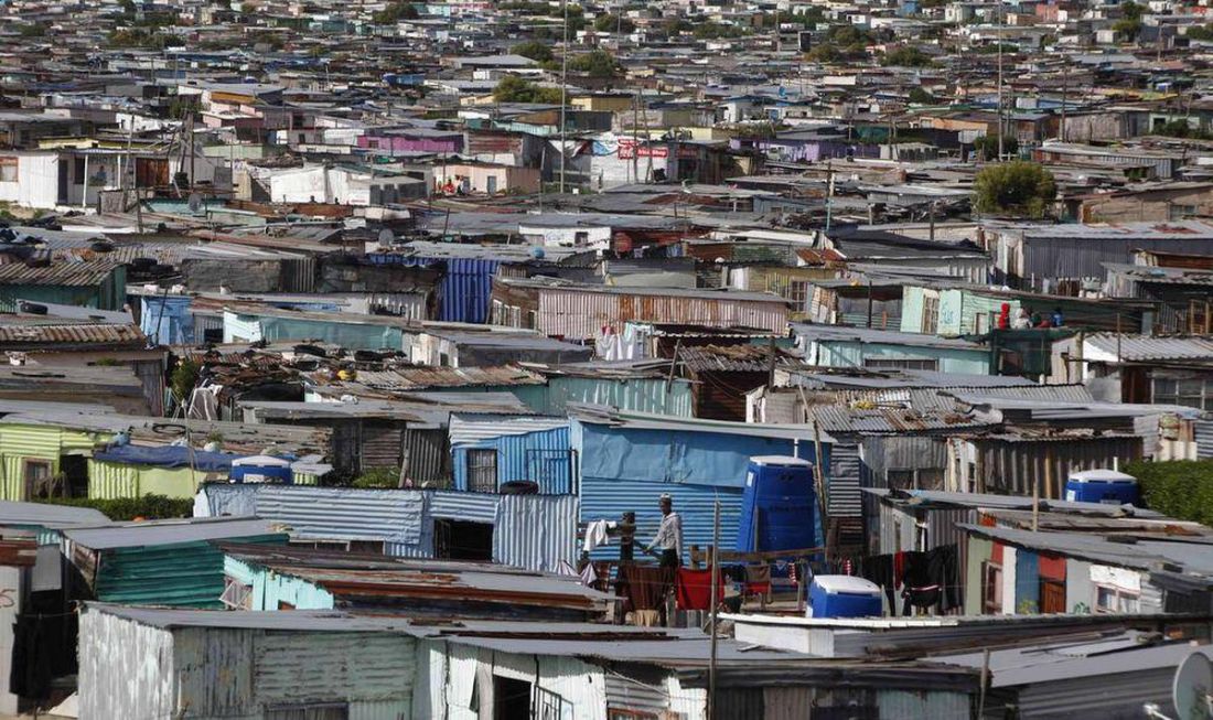
Yet, never in all my years of travel throughout the US have I seen anything that compares with South Africa’s “townships.” These are the places — usually on the periphery of towns — where non-whites (Indians, Africans and “Coloureds”) were sent to live during late 19th Century until the end of apartheid, and from which many of those people or their descendants have been unable to escape. The worst of the terrible townships are several square miles of squalid and densely situated mud or metal-sided shacks topped with make-shift metal roofs, often secured by large rocks. Across some of these roofs, wires are strung like Christmas decorations to steal electricity if there is a nearby power pole. The local sanitation department is often a string of stinking port-a-potties.
To be fair, in other places — although often on unwanted rocky, treeless hillsides — the government is slowly replacing township shacks with less densely spaced modest houses equipped with electricity and indoor plumbing. The design of hundreds of the new houses will be identical, but occasionally the dwellings vary in color. Still, this upgraded sprawl cannot remove from my mind the picture of township conditions we viewed in too many other places of South Africa.
I have read of the vibrant life in some areas of some townships, and also accounts about people who — given the choice — have chosen not to leave their township roots. I know that Soweto Township boasts of having the African continent’s largest hospital, and that it’s a teaching hospital to boot; but I’m not sure that size is really an indicator of quality of care or quality of life. Rather, size may be an indicator of need. . .of rampant nearby illness and injury.
Remnants of the power plant in Soweto, which once provided electricity to Johannesburg but never to Soweto, is a reminder of the cruelty of apartheid policies.
Should South Africa be judged by how far that nation has come, or by how far it has yet to go?
I cannot think of a country I have visited where my advance reading disturbed me more than South Africa. From both historical and current non-fiction and fiction, I got a sense of endless armed struggle which began long before the discoveries of diamonds and gold and the arrogance and atrocities of 17th and 18th Century European invasion. I felt hopelessness for resolution of the economic and racial divide that continues in the current century despite heroic efforts to make changes. I began to worry for my personal safety, which has never occurred as I planned travel to other destinations.
In Johannesburg we chose a modern hotel in the new financial center — Sandton — far north of the city core but at the terminus of the direct train line from the international airport. Here, wide roads and high rises have replaced narrow lanes and shanties. We were transported throughout this, South Africa’s largest city, by means of a “hop-on, hop-off” bus, a conveyance we had never chosen before…..a concession to safety concerns. We learned a lot but experienced less than we would have liked.
In Cape Town we booked a modest older and smaller boutique hotel in the heart of a district reminiscent of New Orleans’ Bourbon Street, where pulsating beats emanated throughout the night from rough bars beneath wrought iron balconies which overhang sidewalks. Here, in addition to the overview which a sightseeing bus provided, we felt free to discover on foot what was down this street or around that corner, confronted by beggars only slightly more than in any other major city of the free world.
In Johannesburg we submerged into the subject matter of struggle: Soweto, the Apartheid Museum, Liliesleaf Farm. Golden hills of waste product and ghetto valleys which still lack electricity are reminders of the extensive gold deposits extracted at the expense of black lives which built this, the world’s largest city not located on a navigable water way.
In more welcoming Cape Town, the undercurrent of struggle can be bathed in ambiance: Camps Bay, V & A Waterfront, Bo-Kaap, Table Mountain, Truth Coffee Roasting,Africa Cafe . In good weather, as we had, the compact city and surrounding ocean front are glorious. But the big news story in Cape Town is refugees, some of whom are protesting their conditions, saying they feel unsafe in South Africa, and demanding resettlement to another country.
Soon, we will be on the road (driving on the left side, of course, thanks to British colonialism). We expect to discover expansive views of land and sea, exquisite white wines, and (at least for us North Americans) exotic game. But, aside from family matters, the centerpiece of our conversations — the question at the top of this posting — is unlikely to change.
Nowhere in America, it can be convincingly argued, is there a better assortment of live music and both fine and funky dining options than in Austin, the capital city of Texas.
Even without the famous ten-day “South by Southwest” festival each March and “Austin City Limits” over two weekends every October, Austin would be on the world’s music map.
Among Austin’s dining destinations are what is claimed to be the largest number of food trucks of any city its size in the USA — more than 1,000 operating every day — serving everything from breakfast burritos, burgers and barbecue to migas, pizza and cupcakes.
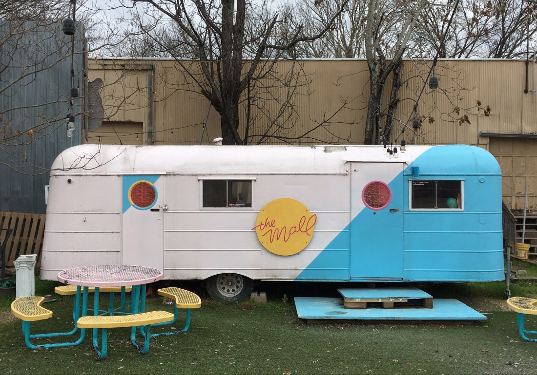
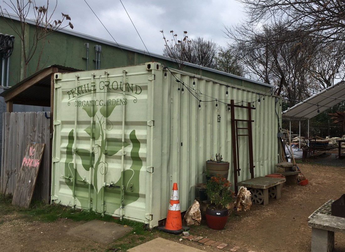
Outnumbering food trucks in Austin by maybe a 30 to 1 ratio are metal shipping containers strewn across the city. Sometimes these containers are as brightly painted as the food trucks, but usually they are as attractive as a rusted railroad box car, and about the same size. They are found in public and private parking lots and in back yards and vacant lots of many businesses and neighborhoods throughout the city. Intrigued, I set off to discover what the purpose of these eyesores might be.
I found that a few containers had two or three sides removed to provide homeowners cantina-style outdoor living. In other places brightly colored containers have been converted to “tiny houses” for Austin’s booming house-sharing franchises like Airbnb. But in most places, it appears that containers provide the storage space which Austin business and home owners need because their buildings lack basements.
I also learned that some containers provide secure storage for the tools of trade for building or remodeling homes at a record-setting pace for the nation’s fastest growing large city. Now the nation’s 11th largest city, Austin shows signs of growing faster than its expansion can be managed and monitored. Major roads are congested with traffic and construction; neighborhood streets are clogged with garbage and recycling bins as well as parked cars which can no longer be accommodated on thousands of narrow lots where two two-story buildings have replaced a single one-story house; and old or new, many houses lack garages.
Nevertheless, music, food, especially friendly people, and wonderful weather (outside of the oppressive summer months) will continue to attract tourists and transplants to what many people consider to be the most livable and forgivable of all Texas cities. Austin’s population increased by more than a third over the past decade, and shows no signs of slowing.
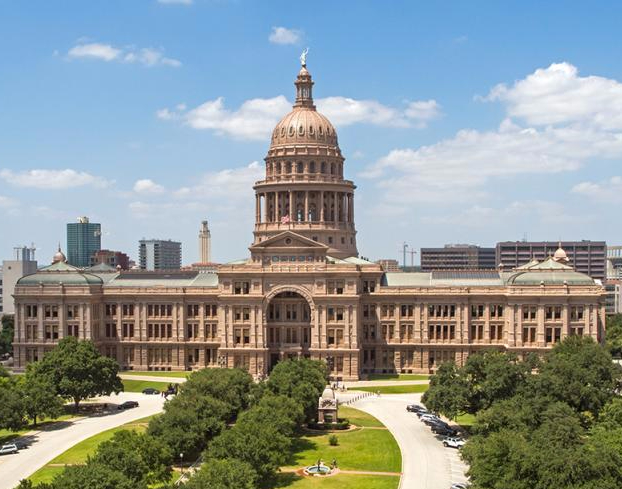
The Texas State Capitol building in Austin is taller than the US Capitol in Washington, DC. The Statue of Liberty would fit in its rotunda. (austintexas.org)
We’re back in that place in Texas where the locals like to pretend they’re really not a part of Texas — Austin. And I’m back to readingGod Save Texas — A Journey into the Soul of the Lone Star Stateby Lawrence Wright, who identifies many of the ways Texas is unique. For example, this mixed bag:
Texas is the only state in the USA which was its own independent country before joining the Union in 1845. That probably explains a lot.
Texas is the only state in the USA to operate its own electrical grid. Lawrence Wright opines that this was done mostly to avoid federal regulations.
Texas has the highest rate of uninsured people in the nation. Whether or not there is a connection, Texas also has the country’s highest rate of maternal deaths.
Texas is where the landmark, now nation-dividing abortion rights case began in 1970. The United States Supreme Court issued its decision in Roe v Wade in 1973.
Following Hurricane Katrina in 2005, Houston sheltered as many as a quarter-million evacuees, about 40,000 of whom became permanent residents of Houston metropolitan area, more than were resettled in any state.
For many years prior to the the Trump administration’s severe restrictions on refugees to America, Texas led all states in the number of refugees accepted, including one-tenth of the 85,000 refugees resettled in the USA in 2016.
Because we love our family, and they live here, we have made another trip to Texas…..a state which always gives me a lot to think about.
The longest serving governor in Texas history (2000 to 2015) became the candidate in the US presidential election of 2016 who, during a national debate, couldn’t remember the name of one of the US agencies he vowed to eliminate (Energy)…..and then was appointed head of that agency by the Trump administration. So we shed no tears that Rick Perry is resigning as the 14th secretary of the US Department of Energy at the end of the year.
Like the president he is now serving, Perry was a Democrat before he became a Republican in 1989; so it’s likely neither man detected any irony in Perry’s appointment. Perry’s record at the Energy department may be as forgettable in American history as the department’s name was in Perry’s memory.
Perry had the dumb luck of presiding over Texas during the first 15 years of the 21st Century, a mostly boom-time of pursuing energy independence in America, when hydraulic fracking extracted record amounts of natural gas from very deep in the heart of Texas. Through repeating cycles of boom and bust, Texas has grown to become home to one-quarter of the top two-dozen largest cites in the USA: Houston (4th), San Antonio (7th), Dallas (9th), Austin (11th), Fort Worth (13th) and El Paso (22nd). Really, El Paso!
Perry had the equally dumb misfortune of becoming the last-minute substitute for Vice President Mike Pence as leader of the USA’s ill-fated delegation to visit the newly elected Ukrainian president, a former comedian, who I suspect has not found the debacle in Washington, DC since October the least bit amusing. Nor do I.
I can just see it……President Trump telling VP Pence that the Ukraine trip is toxic: “Don’t go,” Trump may have told him. “Rick has a terrible memory, so let’s put him in the lead.”
I think it’s time that college football players get paid. After all, they are doing everyone else’s job and are treated so very shabbily.
After making a tackle, especially for a loss, the defender jumps up, sprints or struts around and points to himself. This allows everyone to see who made the tackle, which eliminates the need for a press box spotter to identify the correct player so the PA, radio and TV announcers can name him. Don’t really need any of those jobs anymore.
After a first down run or pass reception, the ball carrier stands and dramatically signals “First Down!” So the officials don’t have to do this anymore.
It’s routine now for defensive backs to shake their heads and signal incomplete passes, even when they were badly beaten by the receiver even though the quarterback over-threw or under-threw the target by ten yards. It’s absurd behavior, of course, but at least it means we can get by with several fewer officials. No need that they also give the signal for an incomplete pass.
And these players are so badly abused off the field. You know, expected to attend classes and turn in assignments at institutions which have paid their tuition, given them the best accommodations and dining on campus, purchased text books which they may or may not open, covered other campus fees, and also provided them a little spending money for whatever other essentials of college life remain…..in all, more than a quarter-million dollars over four or five years for a student-athlete at many of our nation’s universities.
Pretty good compensation and conditions for a late adolescent, but then again, maybe not enough for a kid who has been coddled and catered to since he grew larger than his classmates in high school.
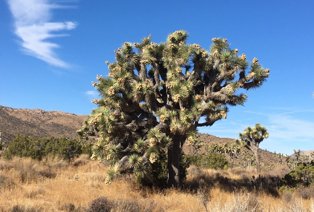
Ten months after our visit as tourists was thwarted by some trashing of Joshua Tree National Park during the partial shut down of the federal government, we finally arrived at this precious park as volunteers with the Earthwatch Institute. We counted lizards, Junipers and Joshua Trees to assist data collection by the University of California – Riverside and the National Park Service for research into the effects of climate change and other aspects of environmental management.
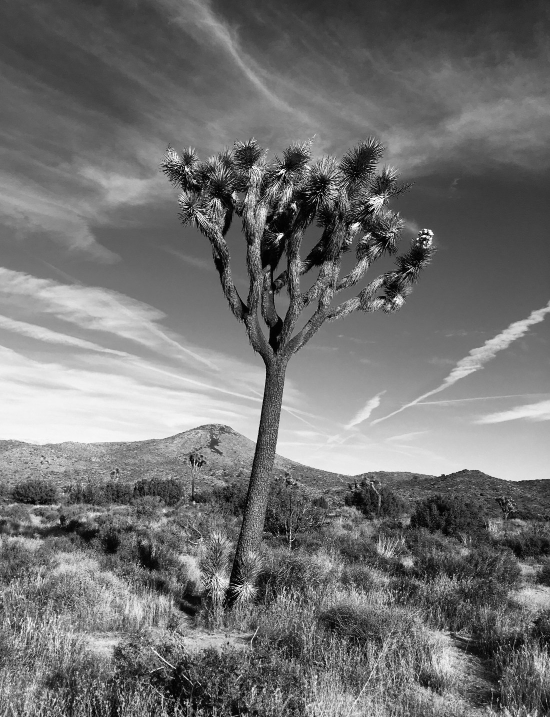
Designated a national monument in 1936 and secured as a national park in 1994, Joshua Tree stretches over nearly 800,000 acres between the higher elevated Mojave Desert to the north and the Colorado Desert to the south. Boulder formations characterize the northeast; but brazen Joshua trees, found nowhere else in the world, are the feature here….. sometimes in solo but more often in random, loose ensemble across the vast desert floors. Almost every living thing in the Park appears to be migrating very slowly to higher and cooler elevations.
While closely related to the lily, the Joshua is a type of tenacious yucca plant — a fierce survivor of the harshest natural conditions and the most foolish human behavior. The slow-growing tree (a little over an inch per year) is said to have been named by Mormon settlers after the Old Testament prophet Joshua, with arms raised to the heavens in prayer. Some of the park’s trees have reached 400 years old, and the species needs more than our prayers to help it survive the so-called modern age.
The park is renowned for birding (250 species), rock climbing, and sunsets, followed by star-gazing. It has been designated as one of the 66 International Dark Sky Parks in the USA, and it hosts a Night Sky Festival each fall.
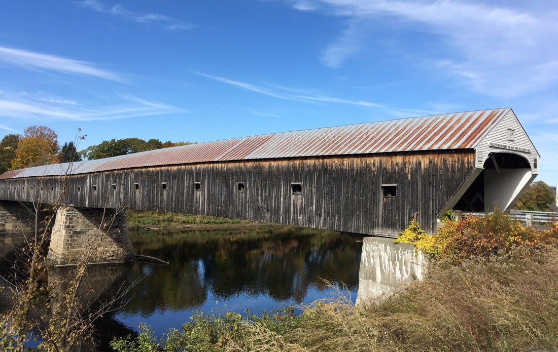
Among New Hampshire’s 55 historic wooden covered bridges is the nation’s longest, built in 1866, spanning the Connecticut River between Cornish, New Hampshire and Windsor, Vermont. Construction cost was $9,000.
I spent a lot of time in New Hampshire….most of the final four years of my adolescence, and a couple of other visits since…..but that’s nothing compared to some of the candidates for President of the United States. They return to The Granite State time after time, year after year, campaign after campaign. They spend so much time in New Hampshire that they ought to pay taxes there. Oh, that’s right…..there is no income tax or sales tax or capital gains tax in this state where vehicle license plates carry the motto: “Live Free or Die.”
New Hampshire ranks 42nd among US states in terms of population and 46th in terms of land mass, but with its early presidential primary — state law mandates that it must be first in the nation — New Hampshire’s influence on selecting finalists for the US presidential election is vastly out-of-proportion to its size. Even worse, its population is 94% white and not at all like the face of the nationwide electorate.
But I have to admit…..New Hampshire’s Dartmouth College is the only place where I’ve actually been on-site to hear a presidential candidate speak…..although protestors didn’t allow him to finish. The speaker was Independent Party candidate, George Wallace.
It was also where I had a front row seat for a performance by a new singing duo called Simon and Garfunkel, and where I had a back row view for a demonstration over the war in Southeast Asia.
It was where I last had the audacity to sing close harmony before large audiences and play football before large crowds.
New Hampshire did not produce my favorite or best years, but they were formative and important years…..as it has been for every presidential election since the state began to host the nation’s earliest primary in 1916.
Since becoming the USA’s 49th state, Alaska has called itself “The Last Frontier.” From the looks of receding glaciers, the end could be sooner than anybody imagined.
The most profound and powerful lessons of our past year’s travel center on how terribly humans have treated one another, and the environment. Evidence was everywhere we wandered. For example….
Throughout Eastern Europe, we were reminded that the same land has hosted horrors century after century for all of recorded history.
On the Southern Italian peninsula, we saw evidence of one civilization building temples and towns on the ruins it made of another civilization, time after time, for thousands of years.
We learned of Sri Lanka’s decades of brutal civil unrest; and within a month of our departure from that island nation, the world woke to news of Easter morning massacres in its capital city of Colombo.
In both Hawaii and Alaska, we learned of the nearly total disregard for the rights and property and culture and dignity of the native populations by much later settlers from other lands, including the United States which, of course, only became a “new” nation after it eliminated most of one civilization and enslaved much of another.
We have been frequently humbled and sometimes horrified by the role of religious arrogance, and by commercial and governmental greed, and by the blatant brutality and decimating diseases of invading forces and influences. Their cruelty was not limited to other people. They also demonstrated disastrous disregard for the limits of natural resources they exploited and the condition of the land, air and water they polluted.
It is the world’s so-called smartest species which has acted and continues to behave the dumbest, and threatens the planet most.
Of course, these thoughts are not novel or new…..
German philosopher Samuel von Pufendorf wrote in 1673: “More inhumanity has been done by man himself than any other of nature’s causes.”
Scottish poet Robert Burns wrote in 1784: “Man’s inhumanity to man / Makes countless thousands morn.”
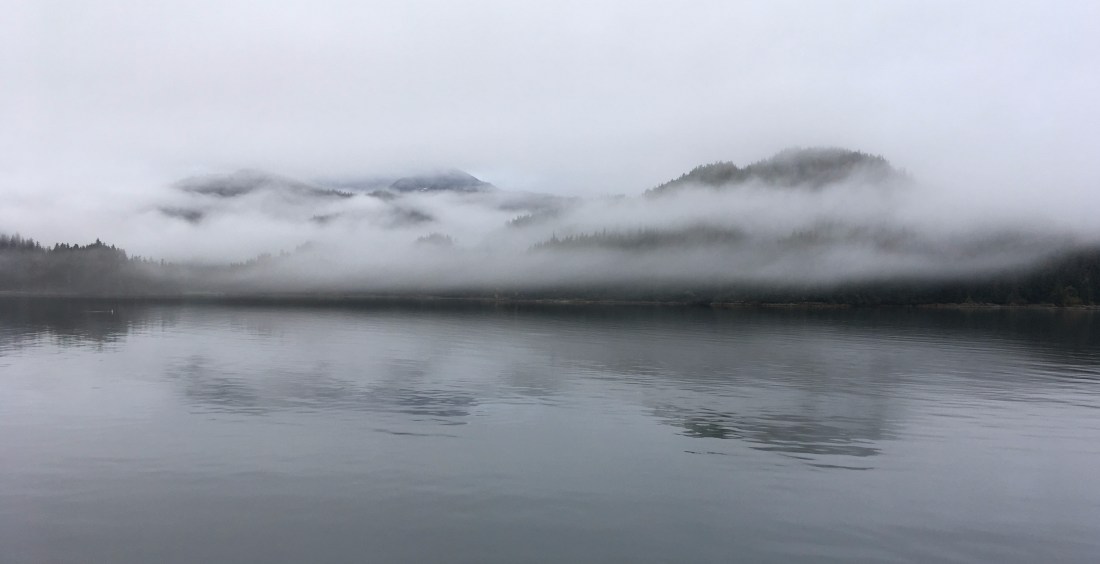
“Perfect” morning weather at the entrance to Kelp Bay along Alaska’s famed Inside Passage.
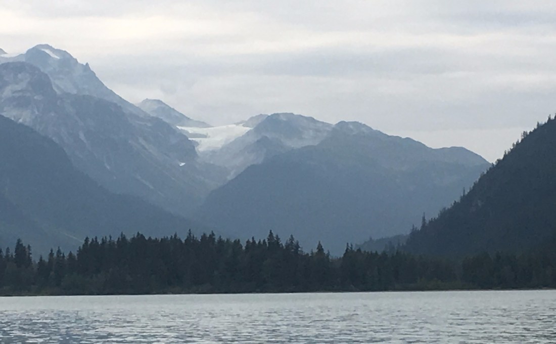
We recently visited Southeast Alaska’s “Inside Passage,” winding among the islands of the 16.7 million-acre Tongass National Forest – largest in the USA. We were there for the same reason many other tourists we encountered said they were visiting: we wanted to see the wilderness before it is ruined by greed and politics and other forms of pollution. And recent events have added urgency.
The summer of 2019 brought soaring temperatures and roaring fires to Alaska.
Wildfires burn hundreds of thousand of acres in Alaska each and every year…..that’s normal. And 2019 hasn’t matched the record level of 2004, when 6.5 million acres burned. But 2019 – with 2.5 million acres scorched and still counting – is worrisome because fire season started earlier than usual and record-setting temperatures have dried out the state and augur a fire season that may extend later than usual into the fall. More than 200 of nearly 600 fires are still burning, and they are threatening more populated regions than in a typical season.
Experts say that Alaska is warming 2.5 times faster than the rate of the lower 48 states, and the frequency and magnitude of Alaskan wildfires fires are increasing. In twelve of the years since 1990, more than one million acres have burned, a yearly milestone infrequently reached before 1990. Lightening is the major cause of Alaskan wildfires; and hot, dry weather — like the summer of 2019 — is the environment in which fires flourish.
Locals say a typical day in Southeast Alaska is cool, overcast and misty – much like the weather we recently experienced there; and when those damp days interrupted this summer’s searing heat wave, most locals were happy. “It’s why I moved to Alaska,” some would say. “And it’s the weather this wilderness needs.”
JER
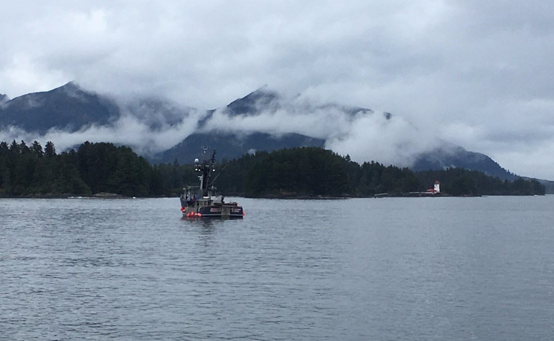
A “Chamber of Commerce” day on Sitka Sound in Alaska.
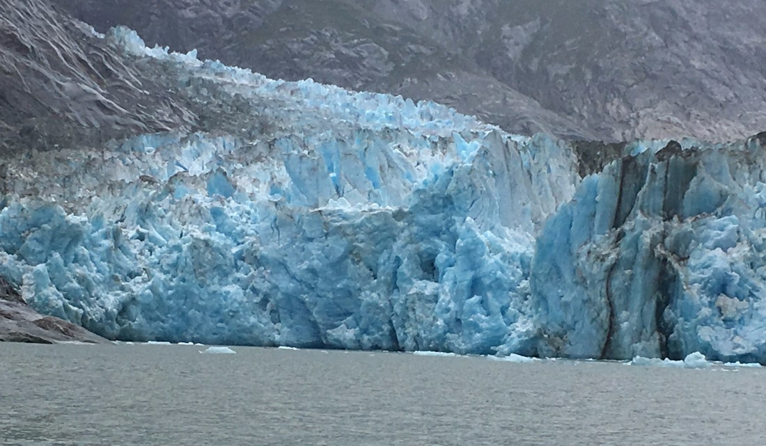
The receding face of Dawes Glacier at the terminus of Endicott Arm in the Tracy Arm-Fords Terror Wilderness of Alaska’s Inside Passage.
My wife and I travel a lot. We also avoid other couples who travel a lot. This is because travelers tend to be boring conversationalists. We’re inclined to talk too much about the places we’ve been and the destinations which the listener “just has to see.”
Over the years as we have traveled, my wife and I have steered clear of group tours and cruises; and when we’ve had no choice but to attach ourselves to a group to gain access to what we desired to see, we’ve gravitated away from time with fellow travelers and have sought out the people who serve those travelers…..guides, drivers, hotel clerks, waiters….. those who have lived their whole lives in the areas we’re visiting as well as the itinerants who have lived and worked in the travel/hospitality industry all over the world.
Many of the Alaskan locals we met recently – I dare say most — are really transplants from “The Lower 48.” Many of the idealistic or independent-minded young people have come to begin careers related to environmental sciences or tourism services. Many older folks have retired from their work in other states and, in “retirement,” have taken summer jobs – for example, driving buses filled with tourists – to savor Alaska’s beauty while they supplement their pensions.
The more I hear the stories of these alternative paths through work and retirement – the bona fide adventures of people who are actually living and working in far-away places — the blander the stories of tourists become.
There is a popular luxury river cruise line that markets its itineraries by inviting tourists to join three or four hundred “like-minded travelers” aboard ship. Frankly, I’d rather spend my precious time along the travel path with local people who have experienced lives which have been entirely different than my own.
JER
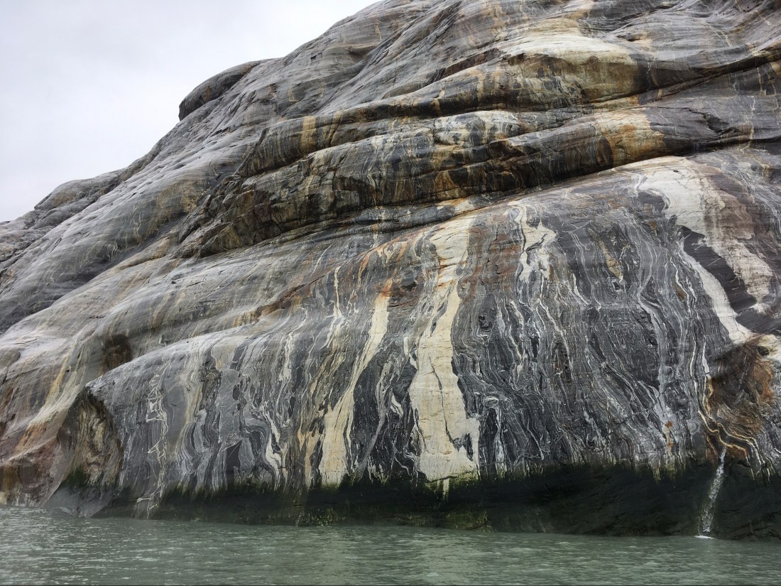
Painted by nature, the cliffs along the shore of Endicott Arm are masterpieces of Southeast Alaska’s Inside Passage.
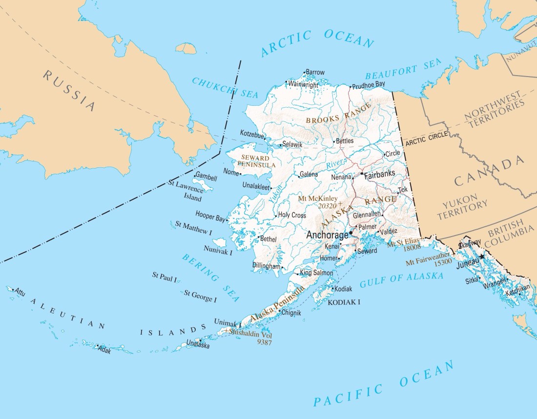
Alaska, and its closest neighbors. (Photo from pasarelapr.com)
We’re heading to Alaska soon, so I’ve been paying closer attention to all the talk these days about Russia — Alaska’s neighbor — playing America for the fool…..for example, by inserting its military into the affairs of neighboring countries and messing with elections in the USA, and in both cases, doing so with impunity.
All this could be true but, frankly, Russia has a long way to go to get even with the United States. After all, the US purchased Alaska from Russia in 1867 for just two cents an acre, about a penny an acre cheaper than the bargain basement price paid for the Louisiana Purchase by the US from France in 1803.
When Alaska became the USA’s 49th state in 1959 (the year before Johnny Horton’s song and the film “North to Alaska” were released), it also became the nation’s largest and most natural resource-rich state. Alaska has helped secure energy independence for the lower 48 states — transforming the US from an oil and gas importing nation (remember the long gasoline lines of the 1970’s) to the world’s number one oil and gas exporting nation — but it may have increased this nation’s dependance on fossil fuels. The Alaska acquisition also has enhanced the USA’s claim in the Arctic whose economic and strategic importance is increasing even faster than the planet’s rising temperatures.
Most important of all, perhaps, is that some Alaskans have claimed they can see Russia from where they live. Which is great. With only a narrow water passage between our countries, rather than some wide expanse of ocean, we may be able to find more mutually beneficial reasons to get along than to blow each other up.
Fan-friendly Comerica Park has also been kind to Tigers’ opponents. (metrotimes.com)
Now that cursed teams of Cleveland and the Chicago Cubs and some inept others are having good moments, the longest streaks of mediocrity or worse in professional team sports are slowly ending; and Detroit’s dismal performances descend steadily toward the nadir of professional sports futility.
Detroit’s most successful franchise — so much so that Motown is sometimes referred to as “Hockeytown” — is the Detroit Red Wings. One of the “Original Six” franchises of professional hockey in America (along with Boston, Chicago, Montreal, New York and Toronto), Detroit has tasted much success, although not recently, last winning the most recent of its eleven Stanley Cups in 2008, and missing altogether the National Hockey League post-season the past four seasons…..often displaced by teams in warm climates, where fans who may not know hockey was once played outdoors have been cheering as championship banners are raised in their plush air-conditioned arenas.
Detroit’s professional basketball franchise — the Pistons — returned last season from suburbia — from the Palace of Auburn Hills, where it was the primary tenant — to Detroit’s sparkling new Little Caesar’s Arena which was designed for ice hockey and specifically the owners’ beloved Red Wings. The franchise has had but one winning season since the 2007-08 campaign. During the National Basketball Association’s 70-year history, the Pistons have won just three championships, the last in 2004. When the Pistons won the NBA championship back-to-back in 1989 and 1990, the team was known as the “Bad Boys.” Now they’re just a bad team.
The Detroit Lions are reaching legendary status for losing. One of four National Football League teams to never win the Super Bowl…..whose last pre-Super Bowl era NFL championship was in 1957 (second-longest drought, behind the Arizona Cardinals)…..whose last post-season victory was in 1991…..the first team in modern times to go a full regular season without a victory (0 and 16 in 2008). The long-suffering Lions have a chance to become pro football’s sentimental favorite, although perhaps not like the Cubs once were for millions of Major League Baseball fans across America. The lovable Cubbies lacked talent, but they and their historic ballpark oozed charm. Not so with the Lions.
Which leaves the Detroit Tigers of Major League Baseball, who are having a dismal season…..again. The last time I saw a good performance at comfy Comerica Park, it was a Rolling Stones concert. As of this writing, the Tigers are 34 games out of first place in the Central Division of the American League. The Tigers already own the tenth worst season in MLB history…..the 2003 Tigers, who went 43 and 119, even worse than the 2002 Tigers who went 55 and 107. Both abysmal seasons could be better than this year’s finish. The Tigers were last World Series champs in 1984….and George Orwell predicted something unusual would happen that year.
Detroit’s four major professional sports teams play in modern state-of-the-art arenas near Detroit’s famous Fox Theatre — the Lions in enclosed Ford Field (finished in 2002), which is literally across the street from Comerica Park (2000); and both are a short walk to Little Caesars Arena (2017). While these modern arenas may be slowly rejuvenating the neighborhood, they haven’t yet done a darn thing for the success of their teams.
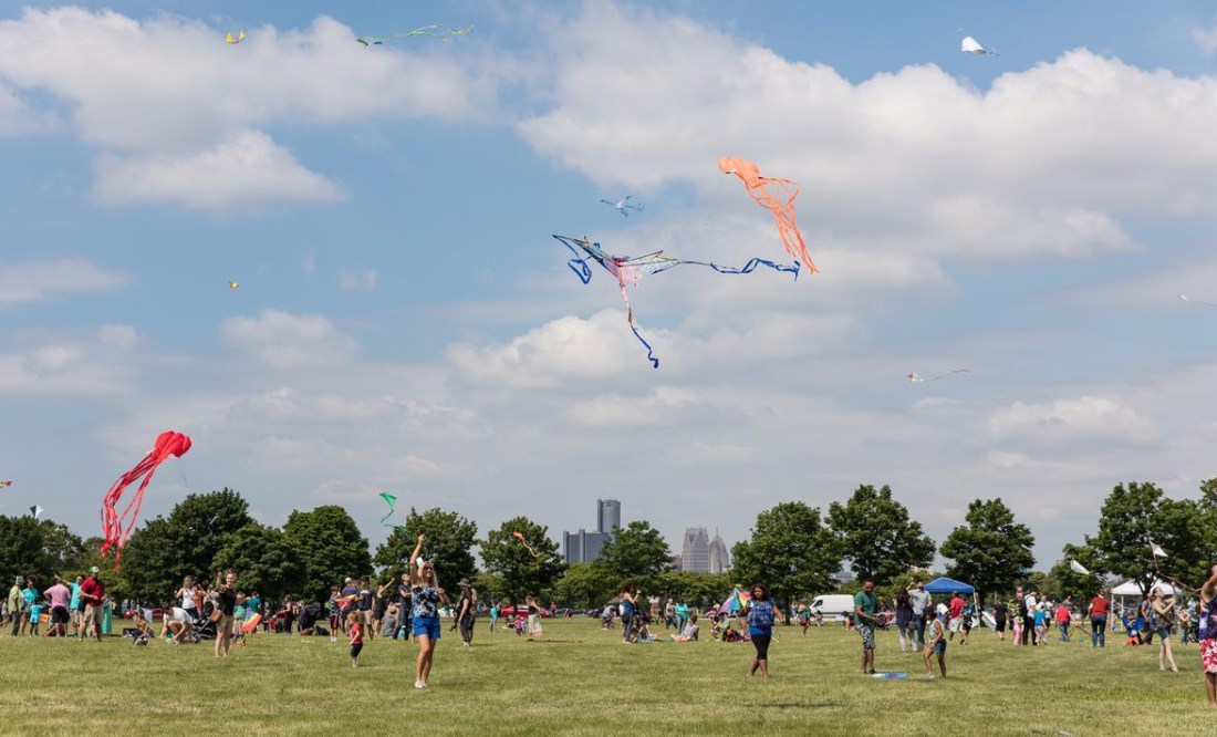
Detroit Kite Festival, 2019. (Google, Michelle & Chris Gerard)
I have toured major metropolitan centers around the world, but ignored one of the world’s most historically important cities located in my own back yard…..Detroit. I have visited the city often for business or a single entertainment event, but rarely as a tourist — until recently.
Eastern Market on a sunny Saturday rivals in scope and ambiance any open air market anywhere in the world, but is less frantic than many in foreign lands. Begun in the 1840’s as “Cadillac Square,” the market has had several different homes; but since 1891, when it was given its current name, the market has been located in its present 43-acre complex of spacious brick and steel “sheds” with surrounding restaurants, shops, warehouses and parking lots. Many buildings are decorated with colorful murals.
The diverse population of Southeast Michigan — including, for example, the largest Arab population outside the Middle East — provides international flavor to this local excursion.
Fifteen minutes away by car is Belle Isle Park, located in the mile-wide Detroit River which separates Windsor, Canada from Detroit. This jewel is a nearly 1000-acre complex of picnic grounds, athletic fields, beaches, lakes, ponds, walks, trails and nature conservancy. It has several buildings of historic importance, including the oldest aquarium in America (first opened in 1904) and the Dossin Great Lakes Museum which is a must-see for any lover of our gigantic and glorious Great Lakes.
Belle Isle’s broad, winding avenues make it a natural for road races, on foot or with roaring high-powered motors, most of which have been manufactured in the “Motor City.” The Detroit Grand Prix is an Indy Car series event often held here in early summer….it’s the only time when drivers are allowed to exceed the 25 mph speed limit on the island’s roads.
The region’s fascination with manufacturing, motors and motion, as well as the unique island location, have made Belle Isle a premiere site for viewing powerboat races, including the Gold Cup from 1990 through 2014 and again in 2018. This event, where the watercraft spend as much time in the air as in the water, is considered the “Indianapolis 500” of hydroplane boat racing.
But it was a much quieter day on Sunday, July 14 when the cloudless blue sky above Belle Isle was sprayed with colors during the third annual Detroit Kite Festival. Light breezes lifted the kites, the spirits of the participants and the prospects for a better future in Detroit.
Not an unusual sight in the Motor City for the past quarter century. (Agnostica)
Arguments can be made that other cities can teach you more about America, but my money is on Detroit.
Yes, Boston is the best place to learn about the American revolution, although Philadelphia may beg to differ. New York City is no longer the gateway for new Americans and barely clings to the claim as the nation’s financial center. Los Angeles’ star as the nation’s motion picture mecca has dimmed. Chicago’s broad shoulders as the nation’s commercial crossroads have slumped. And Washington, DC, which has a memorial, monument or museum exhibit for just about everything that has ever happened in America, is missing a heart.
But if you discover Detroit — from its historical heights to its depths to where it stands now — you are likely to learn more about our nation’s struggles and soul.
Like nowhere else, Detroit provided manufacturing jobs for descendants of slaves. Southeast Michigan was the the magnet of the “Great Migration” from the Deep South of America.
Like nowhere else, Detroit manufacturers created the American Middle Class. A 40-hour work-week paid many thousands of employees enough to own a car and a house, enjoy holidays and weekends off, and take week-long summer vacations. Which is why America invested in highways instead of railroads; it’s why America has suburbs, while Europe and Asia have city-to-city bullet trains.
Like nowhere else, the race riots of Detroit during the summer of 1967 taught us that a job is not all that our nation owes its citizens. This made most suburbs white and turned our cities blacker and browner.
Like nowhere else in America, the rise of suburbs and the fall of industrial manufacturing crushed Detroit. Its population dropped from high of 1.86 million in 1950 — the nation’s fourth largest city — to about 700,000 sixty years later…..1.1 million fewer people within the same city footprint. Thousands of vacant buildings have been demolished; and in their place, there are mostly unkempt green spaces, connected by wide boulevards with sparse traffic.
Because of its dependance on manufacturing, especially related to the automotive industry, the “Motor City” has lagged far behind other major cities in diversifying its economy. But now, a generation after most other cities, Detroit’s neighborhoods are in the midst of rapid gentrification, which is creating another period of flight….new, young (and mostly white) professionals in…..long-time, older (and mostly of color) residents out.
This has all happened elsewhere, of course…..but without the dramatic, defining extremes of Detroit.
If you doubt my assertion regarding Detroit’s place in defining America, read Jeffrey Eugenides’ novelMiddlesex, published in 2002, which leads the reader over three generations from rural Greece to urban Detroit. The transition of Detroit from 20th Century boom-town to 21st Century bankruptcy is not merely background; it’s a charismatic character full of personality and life-altering power.
Not an unusual sight in the Motor City for the past half-century. (Agnostica)
Arguments can be made that other cities can teach you more about America, but my money is on Detroit.
Yes, Boston is the best place to learn about the American revolution, although Philadelphia may beg to differ. New York City is no longer the gateway for new Americans and barely clings to the claim as the nation’s financial center. Los Angeles’ star as the nation’s motion picture mecca has dimmed. Chicago’s broad shoulders as the nation’s commercial crossroads have slumped. And Washington, DC, which has a memorial, monument or museum exhibit for just about everything that has ever happened in America, is missing a heart.
But if you discover Detroit — from its historical heights to its depths to where it stands now — you are likely to learn more about our nation’s struggles and soul.
Like nowhere else, Detroit provided manufacturing jobs for descendants of slaves. Southeast Michigan was the the magnet of the “Great Migration” from the Deep South of America.
Like nowhere else, Detroit manufacturers created the American Middle Class. A 40-hour work-week paid many thousands of employees enough to own a car and a house, enjoy holidays and weekends off, and take week-long summer vacations. Which is why America invested in highways instead of railroads; it’s why America has suburbs, while Europe and Asia have city-to-city bullet trains.
Like nowhere else, the race riots of Detroit during the summer of 1967 taught us that a job is not all that our nation owes its citizens. This made most suburbs white and turned our cities blacker and browner.
Like nowhere else in America, the rise of suburbs and the fall of industrial manufacturing crushed Detroit. Its population dropped from high of 1.86 million in 1950 — the nation’s fourth largest city — to about 700,000 sixty years later…..1.1 million fewer people within the same city footprint. Thousands of vacant buildings have been demolished; and in their place, there are mostly unkempt green spaces, connected by wide boulevards with sparse traffic.
Because of its dependance on manufacturing, especially related to the automotive industry, the “Motor City” has lagged far behind other major cities in diversifying its economy. But now, a generation after most other cities, Detroit’s neighborhoods are in the midst of rapid gentrification, which is creating another period of flight….new, young (and mostly white) professionals in…..long-time, older (and mostly of color) residents out.
This has all happened elsewhere, of course…..but without the dramatic, defining extremes of Detroit.
If you doubt my assertion regarding Detroit’s place in defining America, read Jeffrey Eugenides’ novelMiddlesex, published in 2002, which leads the reader over three generations from rural Greece to urban Detroit. The transition of Detroit from 20th Century boom-town to 21st Century bankruptcy is not merely background; it’s a charismatic character full of personality and life-altering power.
Ingenuity during the New York City blackout of 1977 (AP Photo/Suzanne Vlamis and Business Insider).
On July 13th, exactly 42 years after New York City experienced a wide-spread power outage that darkened Manhattan, history almost repeated itself. I was present for the original event.
I arrived in New York earlier that day, July 13, 1977, checked into a modest hotel on the street that forms Central Park’s southern border, took a walk about Manhattan that featured a moveable feast from street vendors, and returned early to my tiny room. As I was reading, the lights went out; so, with nothing else I could do, I went to bed.
Later, I was awakened by a telephone call from my wife who informed me that she had seen on our television back home that much of the nation’s Northeast was in a blackout. Of course, before cell phones and social media, that was more news than I could obtain locally. She was worried; I was merely sleepy.
The next morning the hotel illuminated its restaurant with candle light and warmed beverages by canned Sterno flame. Then, I walked to my appointment….the set of “Good Morning America”…..where I was to meet David Hartman, the show’s first-ever host….. who was to do a public service announcement promoting high school athletics.
But, of course, there was no power on ABC’s set for its popular morning show. Mr. Hartman included the script I gave him in the papers he gathered up, and he rushed to a private airport where he took a short flight to Washington, DC to host his daily morning show from studios there….after which he recorded our PSA flawlessly in a single take.
David Hartman had been a tremendous high school athlete — especially in baseball — in Rhode Island — and he was a natural spokesperson for the National Federation of State High School Associations which had sent me on this memorable mission.
This year, power was restored in about three hours. The 1977 blackout was a 25-hour event resulting in more than 3,500 arrests and many millions of dollars in damage, none of which was apparent to me as I meandered around Manhattan for the rest of that sunny summer day in 1977.


 (fortune.com)
 (debate.org)